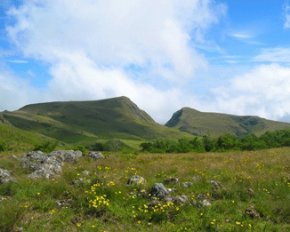
The highest point in the entire landscape of Nigeria is the Chappal Waddi Hill. Towering at 2,419 meters, it stands above the peak and the zenith of any landmass in Nigeria. The Chappal Waddi is located in Taraba State, near the border with Cameroon, in the Gashaka Gumti Forest Reserve and (Gashaka-Gumpti National Park) on the Mambilla Plateau. The Chappal Waddi is a part of the Bamenda-Adamawa-Mandara Mountain chain of Nigeria and Cameroon and it has been cited and regarded as the highest point in sub-Saharan Africa West Africa
The Chappal Waddi is characteristic of the jungle; having a landscape that is extensive hilly; thick forested slopes steeps and slopes and a rugged terrain crossed by leopards and grazed by buffalo. It also is characterized by the scenery of a fabulously lush emerald green jungle inhabited by fascinating primates, brilliantly multi-coloured butterflies, the innumerable species of strange and wonderful fish swimming within the water bodies, mischievous chimps, gushing waterfalls, the Black & White, Colobus and Putty Nose monkeys, crystal pools, plunging valleys, the Red River Hogs and Warthogs, rocky riverbed under the feet etc. Summarily put, it is regarded as a sight to behold and a feast for the senses. Sheer beauty and a form of attainable paradise in Nigeria.
Some interesting facts about the Chappal Waddi Heights:
- The Chappal Waddi is also called the Chappal Waddi Gangirwal. The word Gangirwal is translated to mean ‘The Mountain of Death’. Therefore, the Chappal Waddi is also popularly referred to as the Mountain of Death.
- The mountain is the tallest in Nigeria, andat its peak, it is about 7963 feet tall (an equivalent to the 2419 metres).
- The Chappal Waddi is a part of the Gashaka Gumti Forest Reserve (or the Gashaka Gumpti National Park) on the Mambilla Plateau. This park covers 6,600 sq km (which is about three times the size of Greater London) and is Nigeria’s Largest National Park.
- There is a little village at the base of it called Jauro Hammasale, from which climbing the mountain becomes an adventure and an experience of natural biodiversity, scenery, culture etc.
- A walk or trek across the ‘Gangirwal’ takes about 8-10 days, if time is allowed to visit the remote rural communities and look for wildlife.
- Much of the walking follows high watersheds along the Cameroon-Nigeria boundaries with amazing views of each country.
- The Chappal Waddi has numerous natural habitats passing through it and a large base for biodiversity; for example, a lot of wild life can be spotted there, ranging from chimpanzees, giant forest hog, buffalo, klispringer, leopard etc.
- From the top of the mountain (given that the mountain is the highest peak in Nigeria), one can actually get a spectacular view of Taraba, Adamawa and Cameroon.
- The Chappal Waddi Gangirwal is also regarded as a largely undiscovered area, leaving huge possibilities for research and possible discoveries.
References:
Featured image source: Infoguide


